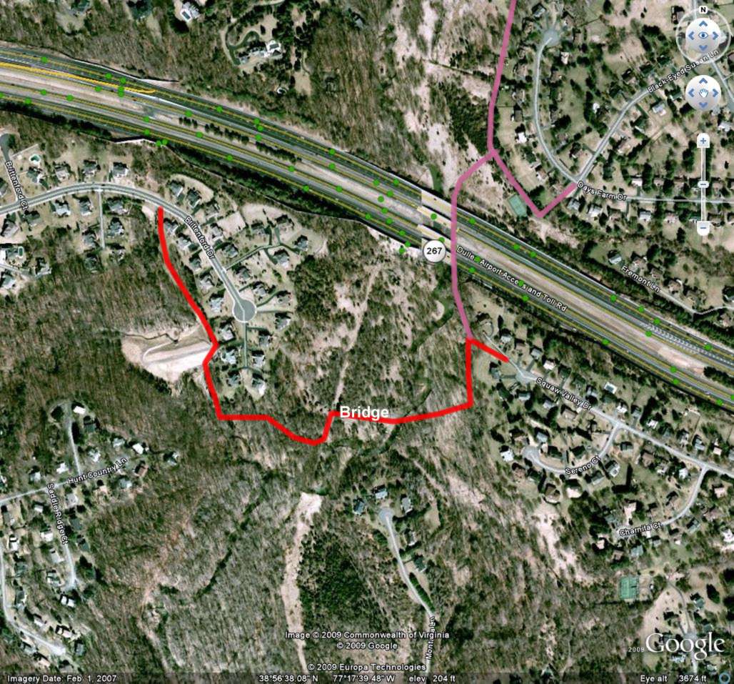
Difficult Run (1) between Brittenford Dr. and Squaw Valley Dr.
3380 foot asphalt trail and bridge over Difficult Run. The asphalt trail would be built parallel to the Cross County Trail in part.
Provides connectivity - High
This trail would connect 4 neighborhoods as well as Reston and Tysons Corner. This assumes that the Difficult Run (2) proposal is also built.
Improves Safety - High
Pedestrians and bicyclists can reach the Tysons area without utilizing busy roads. Bicyclists have been known to fall off their bicycles utilizing the concrete ramp that is part of the existing fair-weather crossing. Older pedestrians are afraid of losing their balance on the crossings.
Provides Access - High
Provides access to Tysons Corner Metro Station.
Provides Recreational Opportunities - High
Provides improved access to Cross County Trail in a northerly direction as far as Route 7 to people unable to utilize fair-weather crossings. Also provides a connection to Meadowlark Gardens for people on the western side of Difficult Run.
Supported by Community – Medium
Fairfax Horses is willing to accept the asphalt trail as long as the existing natural surface trail is kept. Commuter bicyclists would prefer a bridge over the present crossing. Older pedestrians would prefer a bridge also.
Is It Feasible to Build - Medium
A bridge over Difficult Run would be expensive. However, the Park Authority has built expensive bridges in numerous locations over Accotink Creek and Pohick Creek.
Countywide Trails Plan
Yes as part of the Dulles Trail.
Property Map 18-4, 27-2

It is proposed to build an asphalt trail between Brittenford Drive and Squaw Valley Drive. This will require a bridge over Difficult Run. This trail is intended to link communities on either side of Difficult Run together and provide a bicycle route along the Dulles Toll Road from Reston to Tysons Corner. A connection is also proposed under the Dulles Toll Road in the Difficult Run 2 proposal.